Reblogged by kornel ("Kornel"):
EUCommission@ec.social-network.europa.eu ("European Commission") wrote:
Snowy greetings from our space sentinels! 🛰️
Its satellites captured these breathtaking images of Europe’s snow-covered landscapes.
🚀 #Copernicus, the Earth Observation component of the EU Space Programme, provides vital data on climate change, natural disasters, and environmental health, helping us make informed decisions for a more sustainable future.
Let this be a reminder of the magic of the season and the technology helping us to understand and protect our planet.
Attachments:
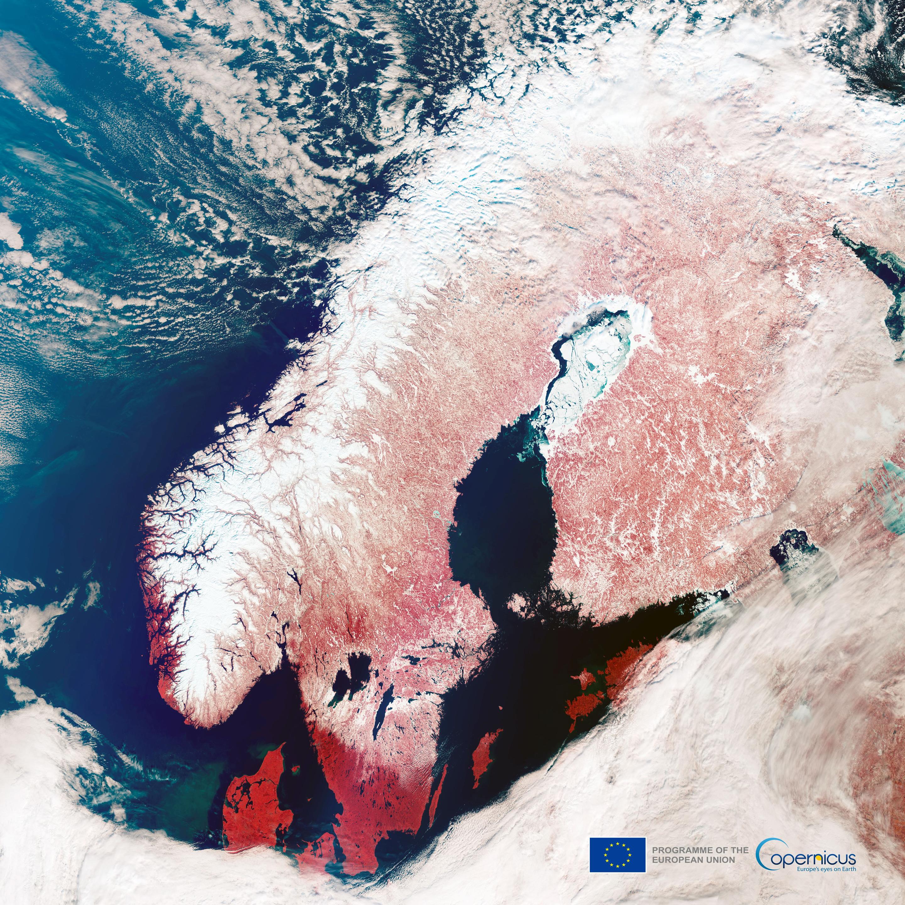
- A satellite view of Scandinavia in winter, showcasing snow-covered land in white and surrounding water bodies in deep blue and black. The red tones highlight areas with vegetation, likely captured in infrared. The landscape features fjords, frozen lakes, and the Baltic Sea. EU and Copernicus logos are visible. (remote)
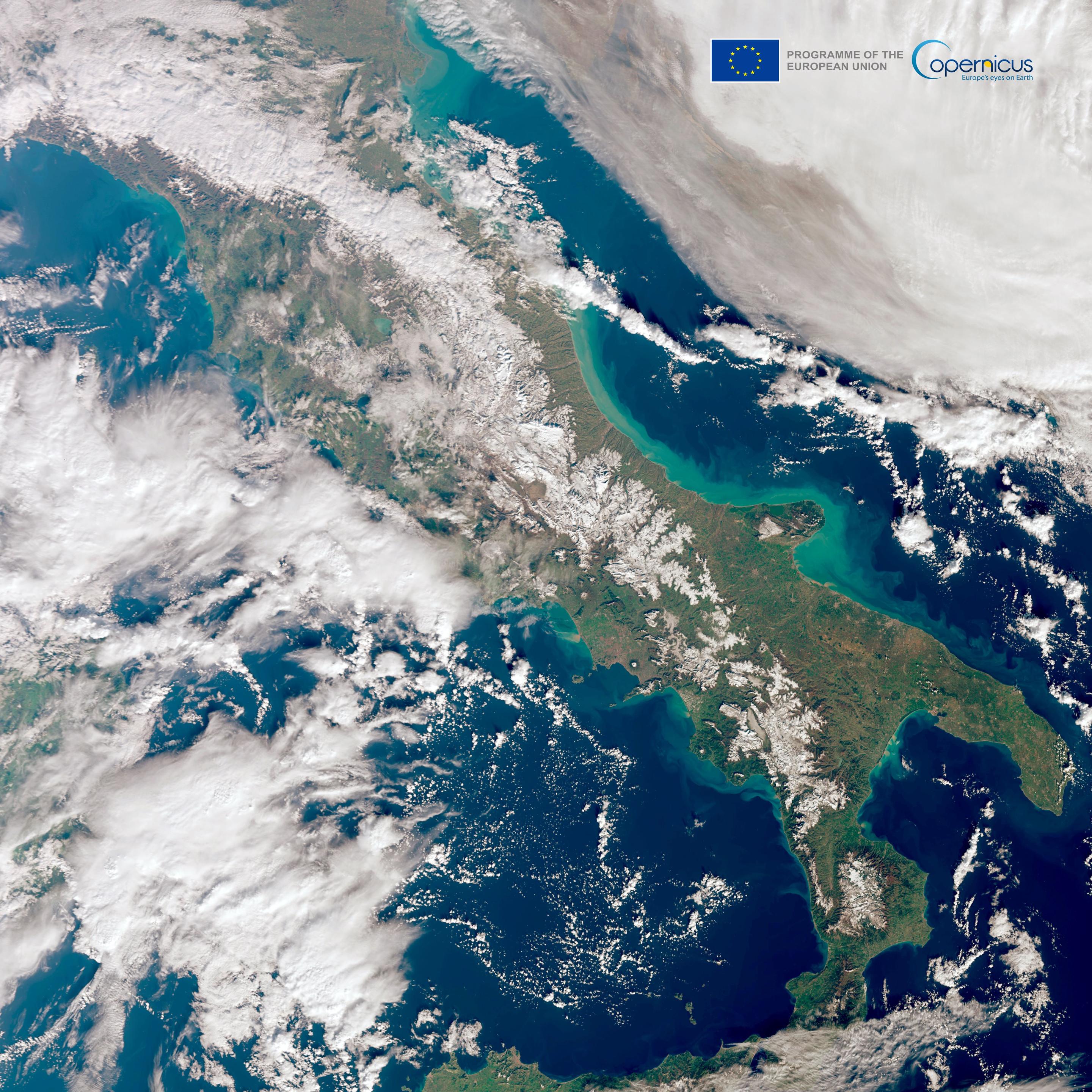
- Satellite image of Italy captured by the Copernicus Programme, showing the Italian peninsula surrounded by the blue waters of the Mediterranean Sea. The Alps in the north and the Apennine mountain range are visible, partially covered in snow. Cloud cover is scattered across parts of the landscape and sea, with vibrant turquoise hues along some coastal areas. The image includes the Copernicus Programme and European Union logos in the top-right corner. (remote)
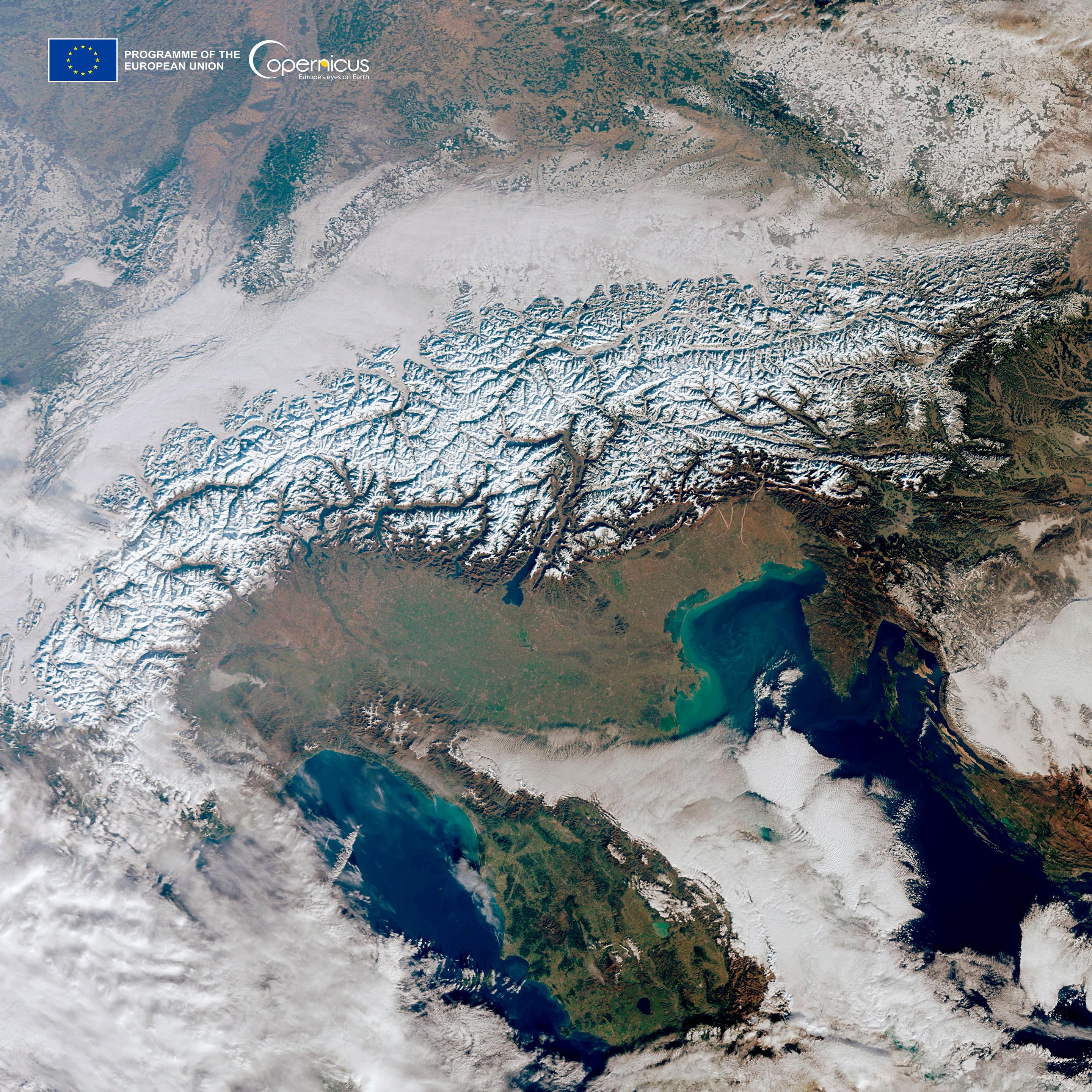
- Satellite image of the Alps region captured by the Copernicus Programme, showing the snow-covered mountain range stretching across parts of Europe, including northern Italy, Switzerland, Austria, and Slovenia. Surrounding areas feature green lowlands, brownish terrain, and bodies of water like the Adriatic Sea to the southeast. Cloud cover is visible over parts of the landscape and coastlines. The image includes the Copernicus Programme and European Union logos in the top-left corner. (remote)
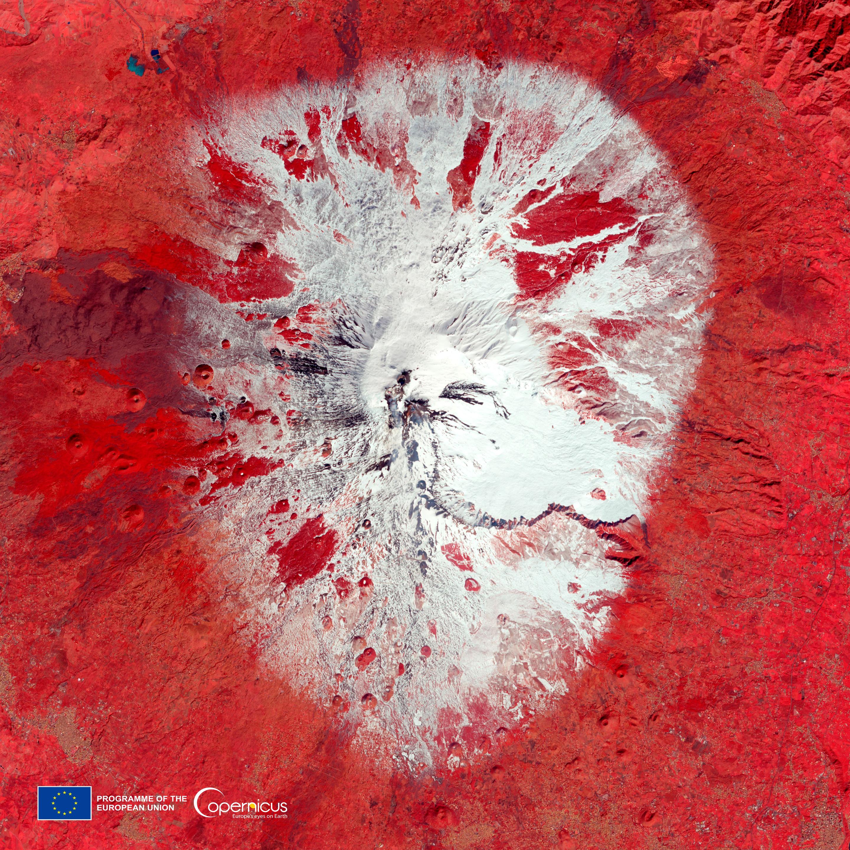
- A satellite image showing Mount Etna, Italy, with snow-covered areas visible in white, surrounded by volcanic terrain rendered in shades of red and brown to highlight vegetation and lava flows. The striking red tones indicate infrared data used to distinguish land features. The image includes a scale and Copernicus and EU program logos. (remote)