Boosted by slightlyoff@toot.cafe ("Alex Russell"):
weatherwest ("Daniel Swain") wrote:
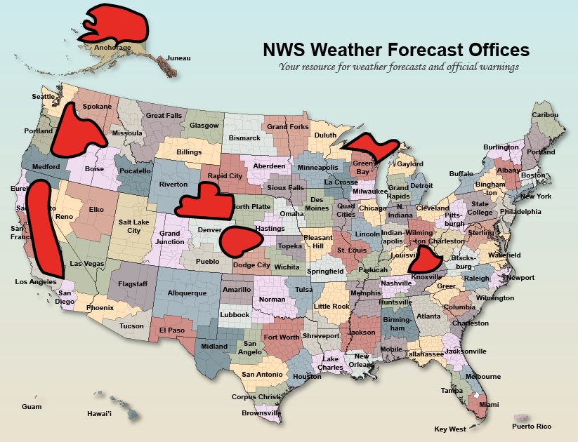
I just created a quick map depicting which portions of the United States are now (as of today) or will imminently be (by early June) without 24/7 local National Weather Service coverage (per Washington Post reporting). #CAwx #CAfire #CAwater #ORwx #AKwx #WYwx #KSwx