Boosted by ChrisWere@toot.wales ("Chris Were ⁂🐧🌱☕"):
quad9dns ("Quad9DNS") wrote:
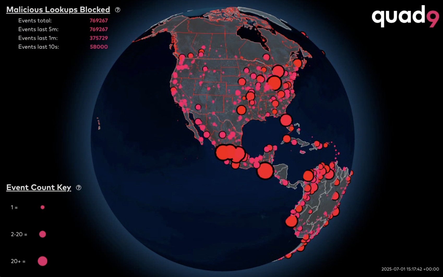
We have open-sourced our visualization tool for mapping realtime events onto a view of the Earth.
The WebGL tool takes websocket data or static JSON with geographic information and allows a variety of views and analysis to be performed on the data that is projected on the map.
Have fun with it!! 😻